Uplands Park is located in Oak Bay, a municipality on southern Vancouver Island, located near Victoria, British Columbia. The main entrances into Uplands Park are located on Beach Drive, Dorset Road, and Midland Road. Uplands Park offers numerous walking trails. Bicycles are prohibited within the Park, but it is a lovely bike ride to Uplands Park. Bike racks are available at the Beach Drive and Dorset Road entrances, courtesy of the Oak Bay Rotary. Uplands Park is about 76 acres. [Wikipedia entry: http://en.wikipedia.org/wiki/Uplands_Park]
[Oak Bay Parks website: https://www.oakbay.ca/parks-recreation/parks-playgrounds/parks-listing/uplands-park
Description:
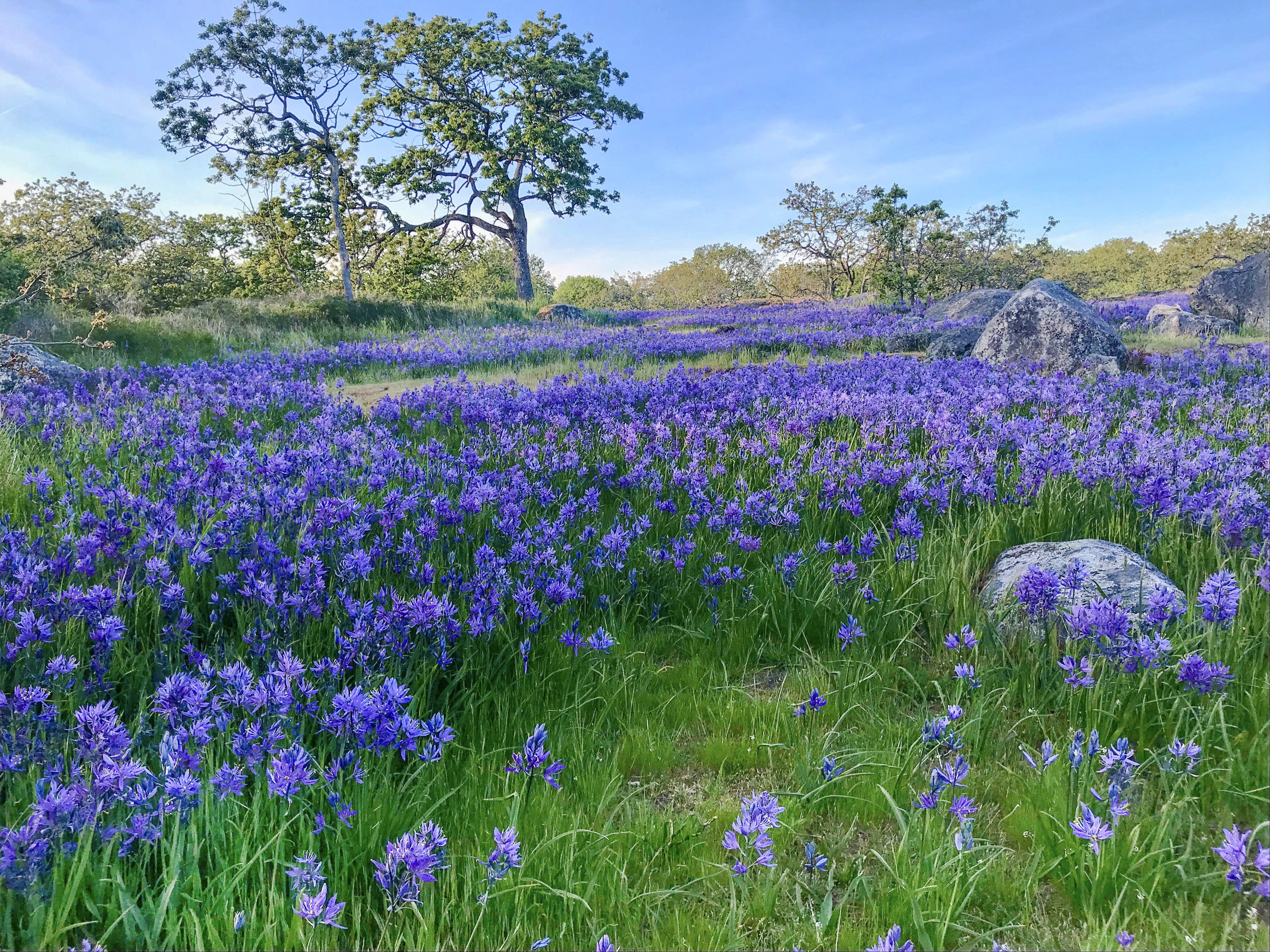
This undeveloped natural area (30.635 hectares) bounded by residences, suburban streets, and the ocean on its eastern boundary provides an excellent example of Garry Oak meadow and associated ecosystems. The park has one of the greatest concentrations of rare plant species in all of Canada.]
There are two parts to Uplands Park. Cattle Point is on the water side of Beach Drive and offers a beautiful shoreline. Uplands Park itself, is on the other side of Beach Drive, across from Cattle Point. The Beach Drive entrance is indicated by a sign that says “Uplands Park”. There is a small parking lot at the entrance to Cattle Point, beside a grassy area, where the Friends of Uplands Park hold their annual events: the Broom Bash (October) and the Uplands Park Celebration (late April or early May) when the Garry Oak Meadow spring flowers are in bloom.
Here is a link to see a Google map showing where Uplands Park is located: http://goo.gl/maps/cGdmK. Two screen shots of this Google Map are inserted below. However, it is best to select the link and go directly to the Google map where you can zoom in and change the view to see either the street map view or the satellite view.


Here is a link to a Google Maps Map Maker image of Uplands Park https://www.google.ca/mapmaker?gw=129&activity_src=0&activity_filter=0&activity_sort=0&ll=48.440732,-123.296621&spn=0.01348,0.021329&z=16&vpid=1370139454257&t=h&lyrs=2&lyt=large_map&hyaw=160.9318437200414

Launch the CRD Regional Community Atlas Map Viewer at http://crdatlas.ca/ and view satellite imagery of Uplands Park at scales as detailed as 1:500.
Uplands Park Trail Map Prepared by Simon Wigzell and Posted April 11-2016.